


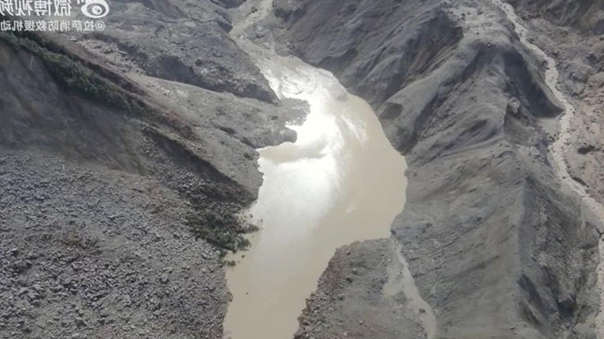
Chinese authorities said Saturday that the threat of a lake bursting near the China-Nepal border has decreased, as satellite images show the body of water formed by this week’s deadly glacier collapse is slowly draining. The development offers a measure of relief for rescue teams working in the disaster zone, though officials caution that significant flood risks remain.
Satellite images taken from Thursday through Saturday morning indicate that water in the lake, which straddles the border at the confluence of two rivers, has been flowing through gradually. State broadcaster CCTV reported, citing the Water Resources Ministry, that the reservoir is steadily decreasing in size.
The ministry said imagery shows the lake’s surface area at the Purepu Tsangpo river was about 99,000 square meters early Saturday, roughly the size of 14 football fields combined. That represents a reduction of about 21,000 square meters compared with images captured on Thursday.
Water levels have been the central concern since Wednesday, when a glacier collapse sent a torrent of rock, ice, mud and debris through Himalayan river systems. The surge swept away a border port complex linking Tibet to Nepal, killing hundreds and leaving thousands unaccounted for.
Related: Le Pen Courts Business Leaders in Debate
Experts and authorities had warned of an extremely high risk of secondary disasters in the valley, particularly from the lake created by glacier debris, which could have endangered rescue operations downstream.
Rescue and Monitoring Operations Continue
State-owned engineering and rescue enterprise China Anneng, which has monitored the lake since Thursday, dispatched a 15-member team Friday equipped with reconnaissance drones, portable satellite stations and mobile surveillance cameras to gather more data. An overflow from the lake on Friday temporarily halted rescue work before further assessment deemed the risks manageable.
In bleak rainy weather Saturday morning, more than 50 rescue workers combed through grey rubble of boulders and mud, calling out for any survivors, according to CCTV. The first team of rescuers and a search-and-rescue dog reached the site of the Gyirong border crossing complex Friday afternoon, describing the location as having nothing left but ruins.
Dangerous conditions at the main disaster zone, complicated by severed roads and communication lines, continue to challenge Chinese relief efforts, state news agency Xinhua said.
China’s death count from the disaster rose to seven early Saturday, with 554 people still missing. Nearly 500 villagers and construction workers, along with all 555 tourists from the area, have been evacuated.
Related: Trump threatens Iran over Strait of Hormuz closure
The pattern here is familiar to those who study high-altitude glacial disasters: a sudden collapse, a surge of debris, and then a anxious wait to see whether the terrain has stabilized. What stands out in this case is how quickly authorities moved to track the barrier lake’s behavior, treating satellite imagery as a real-time diagnostic tool rather than a post-event formality.
A Second, Larger Lake Raises Concerns
Authorities have also flagged another body of water at the bottom of the glacier collapse site that is even larger. “We estimate its area to be over 120,000 square meters, but its depth is currently unknown,” said Chen Hongqi, a senior engineer at the Ministry of Natural Resources’ Geological Disaster Technical Guidance Center.
Flood risks will persist until both lakes have fully drained, according to an official with Nepal’s Disaster Management Authority. That uncertainty hangs over the entire region, even as the immediate threat from the first lake appears to be easing.
The coming days will tell whether the drainage trend holds. For now, the numbers are moving in the right direction, but the margin for error in this terrain remains thin.


